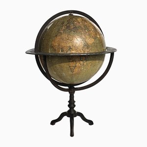
Antique Italian Terrestial Globe by Guido Cora, 1900s
SEK 27,511
You are now following Charts. You can manage alerts in your account settings.
You have unfollowed Charts.
Antique Italian Terrestial Globe by Guido Cora, 1900s
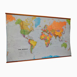
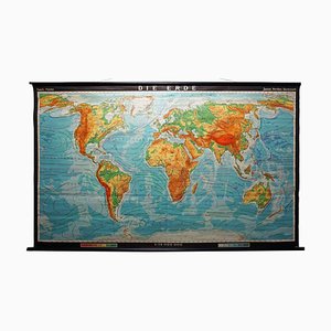
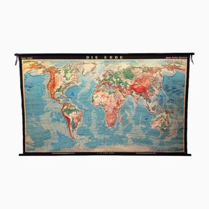
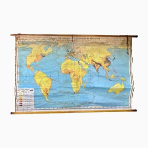
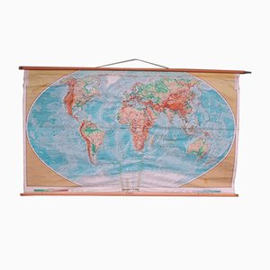
World Map in Laminated Paper
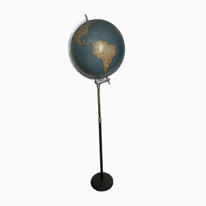
Italian Globe from The Ground
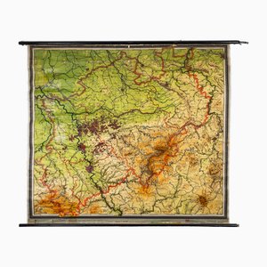
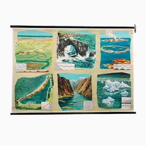
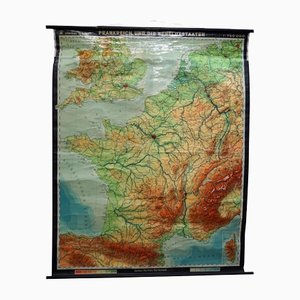
Charts of Physical Maps from North Rhine Westphalia NRW
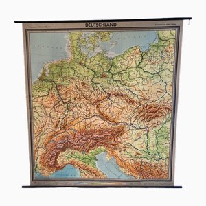
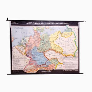
Large Vintage German Linen School Map of Central Europe, 1960s
Vintage Mural World Map, 1970s
Map of the Oilfields in the Near East, 1955

Vintage German School Map of Central Europe, 1961
World Pull-Down School Map by Hermann Haack, 1970s
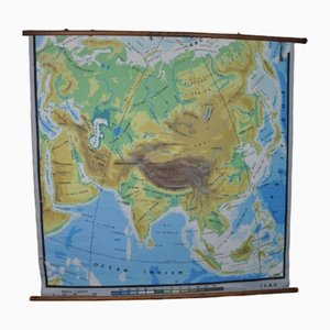
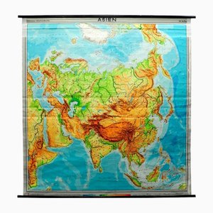
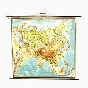
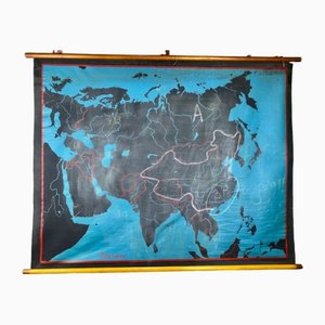
Physical Map of Asia, 1960s
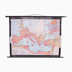
School Wall Map of the Roman Empire by Putzger for Velhagen & Klasing, 1950s
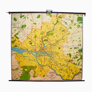
Vintage Map of Hamburg by Dr. Riediger for Verlag JEHA Lehrmittelanstalt, 1960s
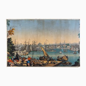
Boston Harbor from Views of North America from Zuber Et Cie, France
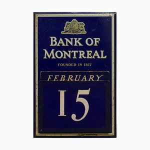
20th Century Tin Plate Perpetual Calendar from Bank of Montreal, 1950s
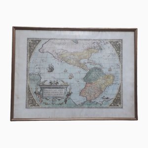
Antique Watercolor Print Map or the Americas, 1890s
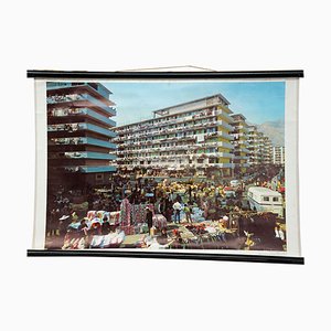
Vintage Living in Hong Kong Wall Chart, 1970s
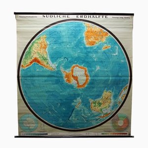
Vintage Southern Hemisphere of the Earth Rollable Map Wall Chart
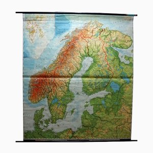
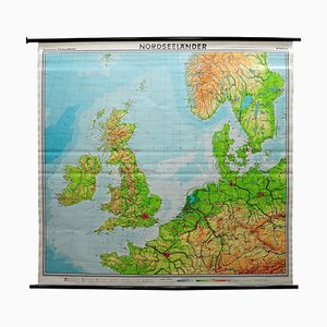
Vintage Scandinavia Norway Sweden Finland Rollable Map Wall Chart Print
Tourists Map of New Yorks Subway System, 1954

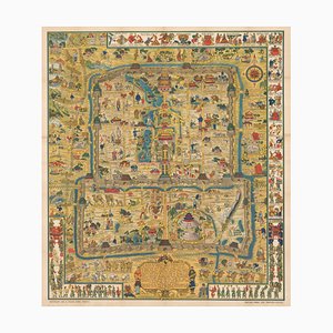
Pictorial Map of Beijing by Frank Dorn, 1936
Vintage Landscape Wall Chart, 1970

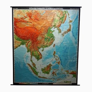
Pull-Down Print Map of Asia
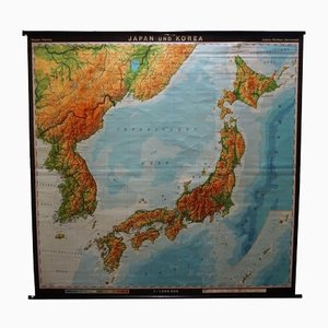
Vintage Asia Japan Korea Rollable Map Wall Chart Poster
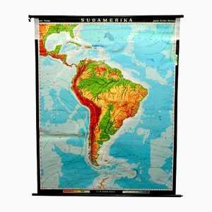
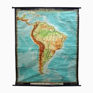
Vintage South America American Continent Pull Down Map
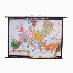
School Wall Map of Europe from Velhagen & Klasing, 1950s
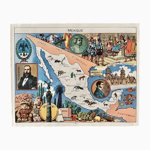
Illustrated Map of Mexico by Émile-Joseph-Porphyre Pinchon, 1948
Large Vintage Colourful Europe School Map, 1960s
Vintage Catch the Sunlight Wall Chart from Schildbuerger, 1970s
Geological Rollable Wall Chart
Vintage South America Pull Down Map Wall Chart Poster
Vintage Southeast Asia China Japan Wall Chart Rollable Map
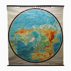
Vintage Northern Hemisphere of the Earth Rollable Map Wall Chart
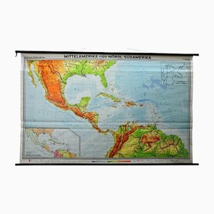
Large Central America Northern South America Wall Chart Poster Rollable Map
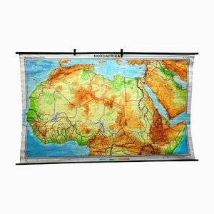
Vintage North Africa Pull Down Map Wall Decoration
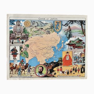
Illustrated Map of China and Japan by Émile-Joseph-Porphyre Pinchon, 1948
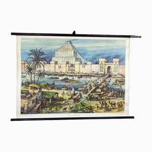
Vintage School Wall Card Print Live in Babylon Posters
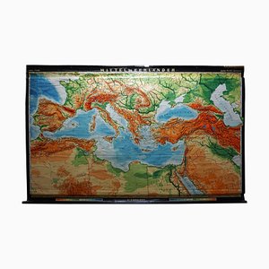
Vintage Rollable Map Mediterranean Countries Wall Chart Mural Poster, 1970s
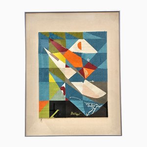
Key Largo Tapestry in Limited Edition by Mathieu Matégot
Large University Chart Physical Map of Africa by Bacon, 1920s
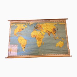
Population Distribution and Density Map, 1960s
Vintage Mural Wall Chart, 1970
Sunflower Botanical Wall Chart by Jung, Koch & Quentell for Hagemann Düsseldorf, 1973

Vintage France Benelux Countries, South England Rollable Map Wall Chart
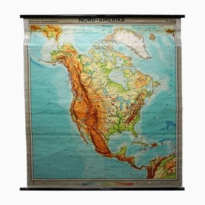
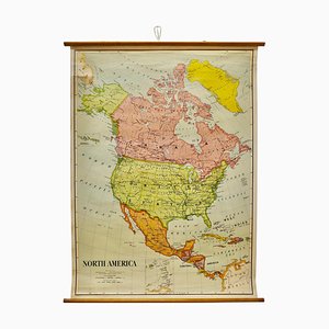
Vintage North American Map Pull-Down Wall Chart Poster Print
Large Vintage People's Republic of China Poster Wall Chart Rollable Map

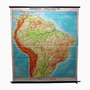
Vintage South America Brasilia and Neighbour States Rollable Map Wall Chart
School Teaching Map of Warschow München, 1950s
Dutch County Map of Cheshire by Janssonius, 1660s

English Collegiate Map, Cambridge, 1838

English Road Map Bristol to Weymouth

Coaching Road Map Cranborne to Dorchester

Antique County Map, Northamptonshire, English, Framed Cartography, Richard Blome

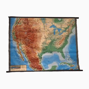
Large Sized Wall Chart, USA, 1980
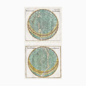
18th Century Celestial Charts of the Northern and Southern Skies, Set of 2
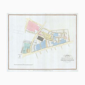
Nashs Plan to Redevelop Charing Cross
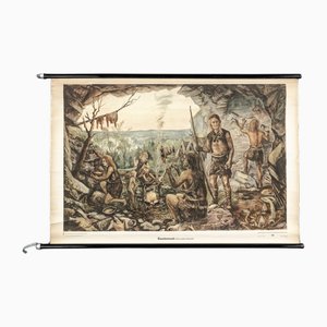
Charts of Maps from Ice Age Man
Illustrated Map of New York by Émile-Joseph-Porphyre Pinchon, 1948
Illustrated Map of Europe by Émile-Joseph-Porphyre Pinchon, 1940s
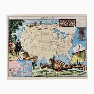
Illustrated Map of the United States by Émile-Joseph-Porphyre Pinchon, 1948
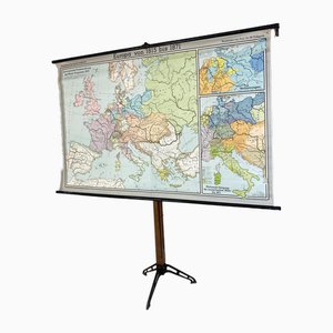
Europe Mural Map, 1970s
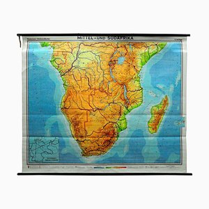
Vintage Map of Central South Africa, 1970s
Vintage Mural Map Mediterranean Sea Near East Countries Rollable Wall Chart, 1970s

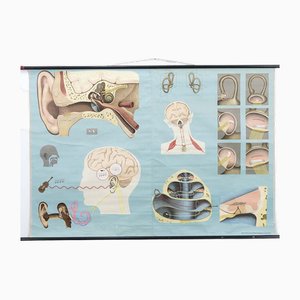
The Hearing and the Sense of Balance Chart
Vintage Geographical Map Asia
Large University Chart Political Map of North America by Bacon, 1920s
Vintage Rollable Wall Chart, 1970
Vintage Rollable Wall Chart, 1970
Vintage Rollable Wall Chart, 1970
Vintage Mural Rollable Wall Chart, 1970s
Vintage Mural Blue Dragonfly Poster by Jung Koch Quentell, 1970s

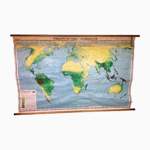
Annual Rainfall Map, 1960s
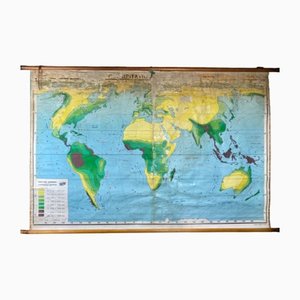
Annual Rainfall Map, 1960s
Population Density Map, 1960s
Beech Asia Map, 1940s
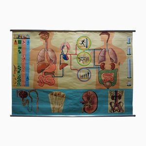
Human Metabolism Body Excretion Water Balance Medical Wall Chart
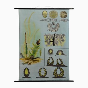
Vintage Spongillidae Pull-Down Wall Chart Poster by Jung Koch Quentell
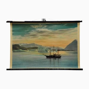
Vintage Landscape Sailing Ship and Coast of Greenland Pull Down Wall Chart
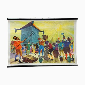
Old Testament Rollable Wall Chart Picture Poster

Alberto Moravia, Ticket Map, Letters With Sketches, 1956

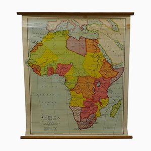
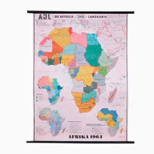
School Wall Map of Africa by Dr. E. Kremling for JRO, 1964
Trending